ᓰᐲ ᐋᐦ ᐱᒫᒎᐎᒡ ᑭᔮᐦ ᐋᔅᐱᑖᑎᒦᔨᒡ | River Flows and Water Levels
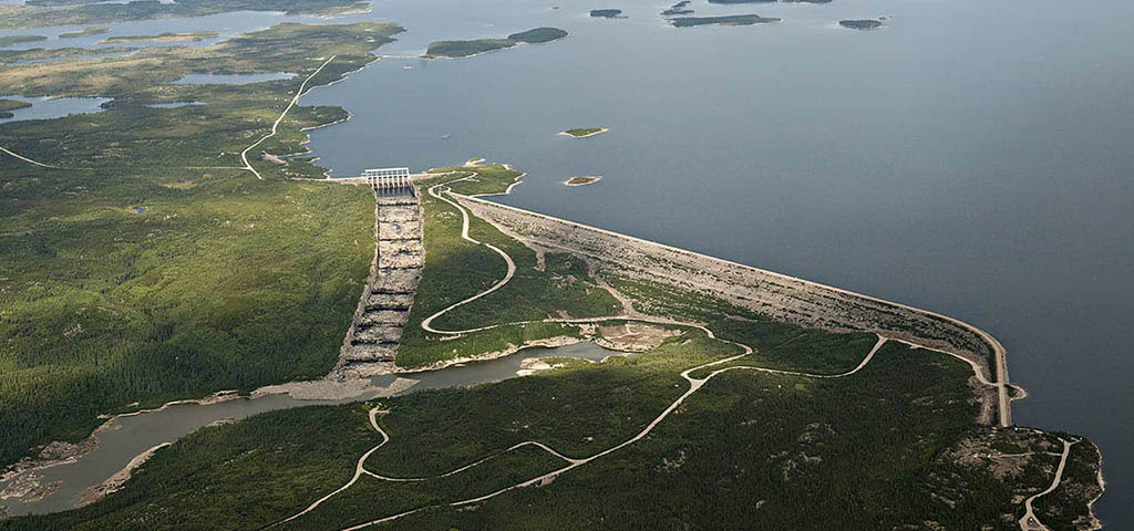
Managing water flows and reservoir levels is important to the Eeyou because these waterways support travel and a variety of harvesting and cultural ac tivities.
Water flow: How much water moves through a downstream river system.
Water level: How high the water is over time, associated with the energy in a reservoir (upstream).
How was Eeyou Knowledge Incorporated into the Study?
During environmental surveys and Ayimihiituunaanuwich meetings, Eeyou land users communicated their concerns and priorities regarding river management.
Results of Hydrological and Hydraulic Studies
Simulation studies (computer modelling (computer modeling tools that determine reservoir levels and downstream flows) were conducted to examine possible changes in water levels and flow that could result from the potential capacity upgrades. Although the modelling results indicate general trends, annual variability will continue to influence water levels and flows.
La Grande-4
The simulations show that the average water level of the reservoir is expected to be moderately lower (0.6 to 1.5 m or 2 to 5 feet) during the winter and spring period. These changes are not expected to alter snowmobile travel on the reservoir but they could change winter harvesting activities along the reservoir shoreline. They could also alter the survival of Lake Trout eggs along the reservoir shoreline. Navigation conditions may also change in June due to lower water levels.
In the downstream portion, water levels and flow could increase for ± 7 km below the La Grande-4 generating station. During periods when the most water is being released, water levels could rise by up to about 1 m (3 feet) near the station and water could flow faster (0.5 to 0.75 metres per second), especially in rapids, but these changes are not expected to affect fishing or navigation conditions.
La Grande-3
The simulations show that the average water level of the reservoir is expected to be slightly lower (0.1 to 0.5 m or 0.5 to 2 feet) in summer and fall, following the upgrade. Snowmobile trails, navigations routes and harvesting areas used by Eeyou on the reservoir are not expected to experience negative changes.
In the downstream portion, water levels and flow could slightly increase for ± 7 km downstream of the La Grande-3 generating station. These increases may change the ice cover, which could lead to changes in the presence of geese and ducks at spring waterfowl hunting sites.
Robert-Bourassa (La Grande-2) / La Grande-1
The simulations show that the average water level in Robert Bourassa (La Grande 2) reservoir is expected to be moderately higher (0.6 to 1.5 m or 2 to 5 feet) during winter. This situation is not expected to affect snowmobile trails, navigations routes or harvesting areas used by Eeyou on the reservoir.
In the upper part of the La Grande 1 reservoir, minor changes in water flow and water levels are expected to occur in a section extending ± 24 km downstream of the Robert-Bourassa (La Grande-2) generating station. These changes are expected to be too minor to affect fishing and navigation conditions.
For more information download the Factsheet on River Flows and Water Levels.
Water flow and level may be affected by climate change. For more information, refer to the Climate Change fact sheet.


Merci pour votre contribution!
Aidez-nous à atteindre un plus grand nombre de personnes dans la communauté
Partagez-le avec votre famille et vos amis